
'The intensity and frequency of heatwaves will be much higher than in previous years over Punjab, Haryana, Rajasthan, Gujarat, Madhya Pradesh and Odisha.'

The current spell of weak monsoon over the country is likely to continue for the next five days, the India Meteorological Department (IMD) said on Wednesday.

After becoming active over the rice-growing Indo-Gangetic plains, the southwest monsoon might witness weak phase for the next 3-4 days over the already rain-deficient region. So far, the main deficit states are Uttar Pradesh (-42 per cent), Bihar (-36 per cent), Jharkhand (-48 per cent), and West Bengal (-24 per cent). According to private weather forecasting agency Skymet, rains in west UP, Punjab, Haryana, Bihar, and Jharkhand are expected to be weak in the next 3-4 days before again picking pace.

In Delhi, Safdarjung, the base station for the national capital, recorded 44.2 degrees Celsius, while Mungeshpur observatory in northwest Delhi, reported 47.3 degrees Celsius.

An official from East Delhi district said the evacuation process began on Monday night after floodwaters entered some areas.

India received 41 per cent more rainfall than normal from October 1-21 with Uttarakhand alone recording more than five times its normal precipitation, IMD data showed on Thursday.

'Till 10 pm last night, we rescued 70 people, after which we had to stop because of bad weather and rain.'

Skymet is credited with correctly predicting the 2009 drought.

This comes a day after the Uttar Pradesh government suspended six officials of civic agencies for alleged gross negligence following the road cave-ins and waterlogging at several sections of the newly-built Ram Path.

Many low-lying areas in West Bengal's sub-Himalayan region were reeling from a flood-like situation while major rivers in Bihar were flowing above the danger level at several places as unabated heavy rain lashed the country's eastern parts on Sunday.

The monsoon spelt mayhem in several parts of the country on Monday, particularly Mumbai where local train services and flight operations were hit and everyday life disrupted as well as Assam that was grappling with floods yet again.

To ensure immediate cooling of the body, the hospital has set up a first-of-its-kind heatstroke unit.

Addressing a press conference virtually, India Meteorological Department Director General Mrutyunjay Mohapatra said September was likely to witness normal rainfall in the range of 91-109 per cent of the long period average of 167.9 mm.

In Uttar Pradesh, the death toll due to lightning strikes rose to 42.

The IMD defines a normal monsoon as one which delivers between 96 and 104 per cent of the 50-year average rainfall for the season.

Heatwave conditions have been prevailing in Odisha since April 15 and the Gangetic West Bengal since April 17, according to the MeT department.
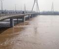
The river's water level reached 206.30 metres, this happened after the national capital received rainfall for three consecutive days. The danger mark of the Yamuna river is 205.33 metres.

Saturday's voting will mark the end to the marathon polling process that began on April 19 month and has already covered 486 Lok Sabha seats in 28 states and Union territories.

The rain ebbed in some places in north India and pelted down in others on Tuesday, with at least seven more people dead and hundreds stranded as raging waters gushed through villages, towns and fields -- from the desert state of Rajasthan to the hills of Himachal Pradesh.

Cyclone Tauktae weakened into a 'depression' and lay centred over south Rajasthan and adjoining Gujarat region on Wednesday morning, the India Meteorological Department said.

The IMD had said the Southwest Monsoon would hit parts of north India including Delhi on July 10, but it had not occurred till Sunday evening.

In view of the safety of the passengers, the district administration stopped the passengers at Sonprayag and Gaurikund due to continuous bad weather.

Mercury hovered around 40 degrees Celsius in large parts of the country on Monday as the Indian meteorological department predicted heat wave conditions in parts of east India over the next four days and the northwest region over the next two days.

The India meteorological department has stated that day temperatures are likely to be above normal by 0.5 degree Celsius, reports Sanjeeb Mukherjee.

The water level at the Old Railway Bridge crossed the 208-metre mark Wednesday night and rose to 208.48 metres by 8 am on Thursday. It is expected to rise further, according to the Central Water Commission, which has termed it an "extreme situation".

A round-up of the Ranji Trophy matches played on Saturday.

Despite high exposure to floods, Assam, Bihar, Uttar Pradesh, Odisha, and Sikkim are the best performing states in terms of flood early warning systems (EWS), according to the report by independent policy research think tank The Council on Energy Environment and Water.

The situation could worsen if weather predictions of more rain in the capital and upper catchment areas come true.

Above-normal heatwave days are predicted in most parts of central, east and northwest India during this period.

For the second successive day, not a single ball could be bowled at the Shaheed Vijay Singh Pathik Sports complex in Greater Noida putting the venue under scanner and making it an international embarrassment.

According to the India Meteorological Department (IMD), the Ayanagar weather station recorded 99.2 mm rainfall, the maximum in the city, during the 24-hour period ending at 8.30 am on Thursday.

The Yamuna river in Delhi swelled to the highest recorded level in 10 years on Tuesday and is expected to rise further, officials said on Tuesday.

Delhi is likely to receive the first monsoon showers on June 30 or July 1, India Meteorological Department (IMD) officials said on Tuesday.

The national capital, parts of which reeled under heatwave conditions for the past few days, had some relief on Wednesday with strong winds and partly cloudy skies witnessed during the day.

India is likely to experience below-normal monsoon rainfall this year, with a 20 per cent chance of drought due to the end of La Nina conditions and the potential for El Nino to take hold, private forecasting agency Skymet Weather said on Monday.
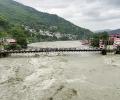
Incessant rains unleashed more death and destruction on Monday in parts of north India, with 37 people killed in landslides and other rain-related incidents in the last two days even as the Army and NDRF teams stepped in to intensify the relief and rescue operations.

The southwest monsoon is expected to reach Kerala during the next two to three days, marking a sluggish start to the seasonal rains that are the lifeline of India's agri-based economy.

The India Meteorological Department said the southwest monsoon further advanced into Delhi, Uttar Pradesh, Himachal Pradesh, Jammu and Kashmiri, some parts of Punjab, Haryana and Rajasthan on June 30.

No part of northwest, central and east India is likely to record a heatwave over the next five days, the MeT office said.

While it hit the national capital two days before schedule, its entry into the financial capital is two weeks late, the Met office said.
